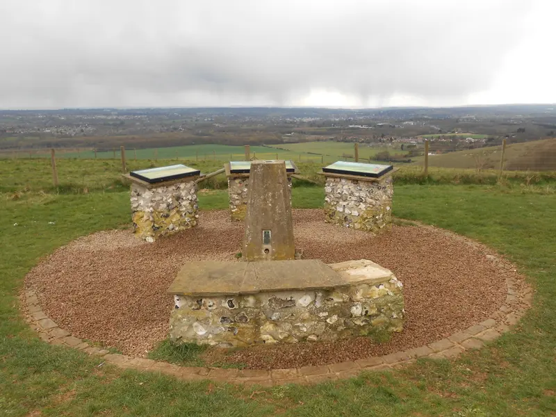
Before planning a walk from Bearsted towards Thurnham, decide whether you want a village outing, a countryside walk or a visit to White Horse Wood. Those are related ideas, but they are not interchangeable. A plan that begins as a short wander can become much more demanding if the destination keeps moving farther away.
This page helps you choose and prepare a route using current mapping and official information. It does not publish an unverified turn-by-turn circuit, distance or walking time. The most useful starting point is a clear destination, a route you can check and a return plan that still works if you walk more slowly than expected.
Choose the purpose before the mileage
For some people, the pleasure is in connecting the village with the wider landscape on foot. Others mainly want a view from the Downs and would prefer a shorter walk once they arrive. Write down which matters more to you. That single choice can prevent unnecessary distance and make the day more enjoyable for everybody involved.
If the view is the priority, consider the official White Horse Wood trail as a separate outing. If walking between places is the priority, allow time to study the connecting paths carefully. Do not use the existence of a short country-park circuit as evidence that the approach from Bearsted is equally short or straightforward.
For a group, ask about comfortable distance and terrain before choosing the route. Someone who enjoys a long level walk may have different needs on uneven ground or slopes. A shared plan should reflect the least suitable section, not just the most attractive destination.
Use a current map to check the whole connection
Consult current rights-of-way mapping and official notices for the area, then trace the complete route from your actual starting point. Pay attention to road sections, crossings, junctions and the location of the return. A line on a small phone screen can conceal a detail that matters when you arrive on foot.
Distinguish a named road, an established trail and a public footpath. A historical name or a line visible on an aerial image does not establish that you can walk wherever you wish. Follow the route and access information from an appropriate mapping source, together with signs and closures on the ground.
Keep an offline copy or another usable means of navigation. A saved screenshot should include enough surrounding context to help if you miss a junction, rather than only a narrow strip around the intended path. Make sure someone in the group knows how to interpret it before setting off.
Build a realistic time allowance
Distance is only one part of timing. Add time for navigation, road crossings, rests, photographs and anything that may slow the group. A route estimated for continuous walking can take much longer when its purpose is to enjoy and photograph the landscape.
Choose a turnaround time as well as a destination. That gives you a decision you can use if progress is slower than expected. It also avoids the feeling that you must reach a particular viewpoint simply because you named it before leaving home.
Leave a margin before a train, parking deadline or the end of useful daylight. The margin should not be the time you already expect to spend walking back. It is spare time that allows the plan to cope with an unexpected pause or a wrong turn without becoming a rush.
Check weather for the kind of terrain involved
A pleasant forecast in a sheltered village setting may not describe how an exposed part of the walk will feel. Consider wind, visibility and recent rainfall alongside temperature. Prepare for the conditions of the route rather than the appearance of a sunny photograph taken there at another time.
After wet weather, reassess the suitability of surfaces on arrival. Do not assume that a route is easy because it is popular or because a guide describes it as scenic. If conditions do not suit your footwear, equipment or group, change the plan while that is still simple.
There is no obligation to keep the original destination. A shorter village visit can be worthwhile in its own right. Our things to do in Bearsted guide offers a gentler alternative that does not depend on reaching an elevated viewpoint.
Give photography a place in the schedule
Choose two or three planned photography pauses rather than stopping unpredictably at every possible subject. This makes it easier to share the walk with people who are not carrying a camera. A wide landscape, a path or tree study and a small detail can create a varied record without dominating the day.
Keep the equipment suited to walking. A phone or a single lens often gives more freedom than a bag of alternatives. If you bring a tripod, only use it where it can stand without obstructing the route, and account for the extra time needed to set it up and pack it away.
Avoid composing while still moving across uneven ground. Stop somewhere appropriate, look at the scene, make the photograph and put the camera away before continuing. Separating walking and photographing usually improves the picture as well as keeping the outing more comfortable.
Make the return as clear as the outward journey
An out-and-back walk has the advantage of a familiar return, but it still needs timing and navigation. A circular route can be appealing, yet the second half deserves as much checking as the first. Do not leave it as an optimistic line joining the destination back to the start.
If you plan to finish somewhere different, verify the transport connection before committing to the route. Check services on the actual day, including any disruption or changed timetable. For arrivals and returns through Bearsted station, our train planning guide links to the relevant operator information.
Tell someone your intended route and expected return where appropriate, especially if walking alone. Keep the plan simple enough to explain. A clear description of where you expect to be is more useful than a vague intention to explore until you feel ready to come back.
Know what the official destination pages establish
Kent Downs' Thurnham Castle page locates the ruins through White Horse Wood and notes the North Downs Way below the site. Use that as destination context, not as a complete route from Bearsted. Kent County Council's park information provides the park map and current visitor resources.
Thurnham Parish Council is another source for local context and notices. Check each source for the question it actually answers. Combining a historical description with an old route photograph does not produce a verified current walking guide.
After your walk, a few accurately captioned photographs can become a personal record of the connection between places. Browse the Thurnham collection if you would like to think about those wider views as wall art. The walk itself should remain worthwhile whether or not you return with a picture you want to frame.
A place for your wall.
Explore the collection, then choose a size and finish at your own pace.